
- NOAA, Arctic Oscillation
- Atmospheric and Environmental Research blog, Arctic Oscillation Analysis and Forecasts
- Frederic Hourdin, et al., The art and science of climate model tuning
- Northeast Regional Climate Center, Northeast Drought Update
- UMass Agricultural Extension, Gypsy Moth: Now that We Have Survived the Largest Outbreak Since 1981, What’s Next?
Tag Archives: weather
So much for “Dry”
We were in an extended dry period – hadn’t rained in sixteen days before this AM and only about half normal rainfall over the past few months. We now stand to make up a few months accumulated rainfall deficit in a few days. Quantitative Precipitation Forecast for the next five days:
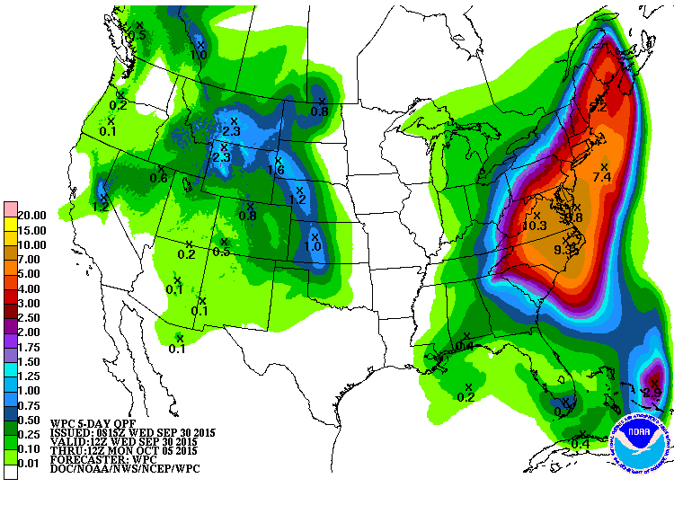
And the seven day forecast is for another inch plus. Four to five inches in our backyard would be significant but check out the prediction for NW Virginia. Yowza.
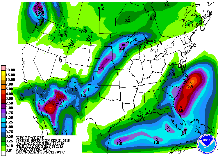
Dry
Very dry. It hasn’t rained in over a week and it when it did that broke up a ~3 week dry spell. And now NOAA’s Quantitative Precipitation Forecast for the next seven days:
Jennifer Francis, Understanding the Jetstream
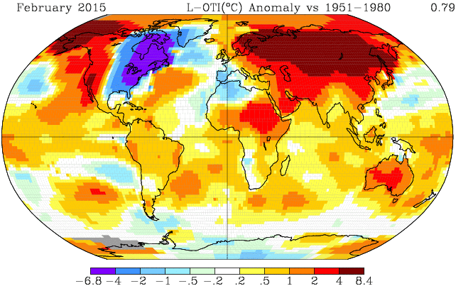
Yup. February was mighty cold in these parts.
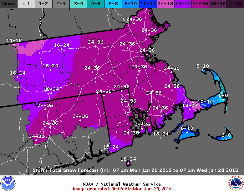
It just doesn’t quit – Part 2
The National Weather Service throws in the towel:
.LONG TERM /MONDAY THROUGH SATURDAY/...
*/ HIGHLIGHTS...

 - POTENTIAL MIDWEEK STORM SYSTEM MAINLY IN THE FORM OF SNOW
 - CONTINUED BITTERLY COLD
 - NO BREAK IN THE WEATHER PATTERN
 - NEXT CHANCE OF WARMTH: SOMETIME SPRING INTO SUMMER

*/ OVERVIEW...

ENSEMBLE-MEAN PREFERENCE FORECAST. POSITIVE TELECONNECTION PATTERNS.
BROADER CYCLONIC FLOW CONTINUES THROUGH WHICH WE WILL SEE ADDITIONAL
WEATHER SYSTEMS FOLLOWED BY SHOTS OF COLD ARCTIC AIR. IT APPEARS WE
WILL NOT SEE A BREAK IN A PATTERN OVER THE NEXT WEEK. THE MASSIVE
AMOUNTS OF SNOW WILL REMAIN TO REMIND US JUST HOW AWFUL WINTER HAS
BEEN AND HOW WONDERFUL IT CAN BE LIVING IN NEW ENGLAND. HAPPY DAYS
ARE HERE AGAIN!
It just doesn’t quit
The NWS is predicting 10-14 8-10 10-14 inches tonight and tomorrow. Here’s the full forecast for the weekend (not from NWS):
It’s on! (Major storm forecast for tomorrow night thru Tuesday)
What is the Madden-Julian Oscillation?
Local meteorologist David Epstein has a nice discussion of the medium-range weather forecast for the New England region on boston.com, January Will Arrive On A Cold Note. (His Weather Wisdom posts are very good in general.) El Nino and the Madden-Julian Oscillation (MJO) featured in his discussion. El Nino comes up pretty regularly in weather discussions but the Madden-Julian Oscillation? I’d never heard of it. From NOAA:
The Madden-Julian Oscillation (MJO) is a tropical disturbance that propagates eastward around the global tropics with a cycle on the order of 30-60 days. The MJO has wide ranging impacts on the patterns of tropical and extratropical precipitation, atmospheric circulation, and surface temperature around the global tropics and subtropics. There is evidence that the MJO influences the [El Niño/Southern Oscillation] cycle. It does not cause El Niño or La Niña, but can contribute to the speed of development and intensity of El Niño and La Niña episodes.
Thought for the Day: 13 November 2013
Step 1 in the battle to curb global warning: Educate people on the difference between weather and climate.